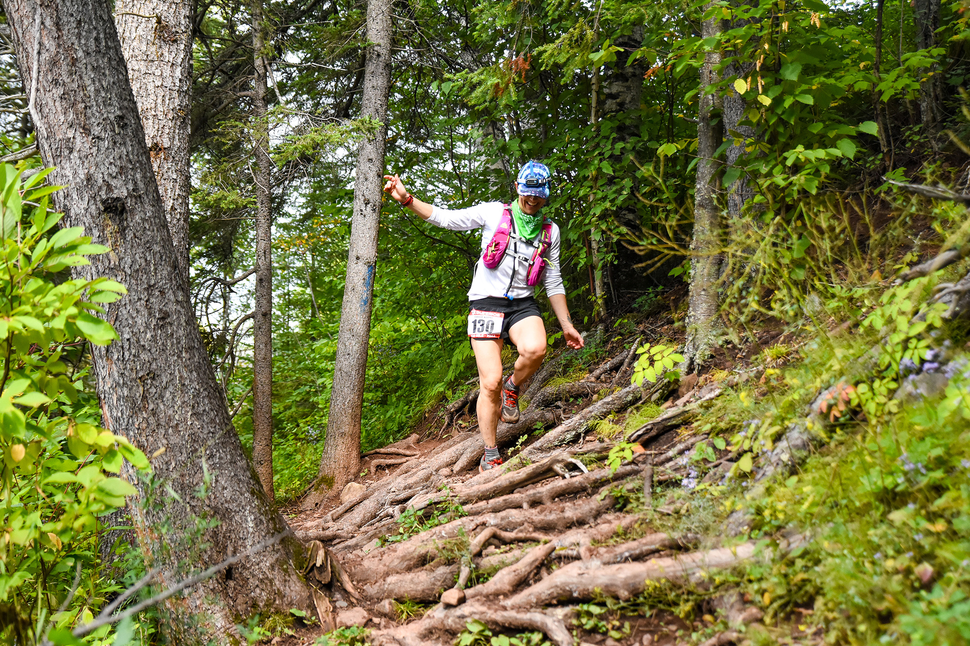
Photo Credit David Markman
Greetings Runners,
With under three weeks to go, I wanted to check in, and extend an early welcome to everyone. We cannot wait to see you all on the North Shore in a couple of short weeks! I will, as usual, be sending out our final / week-of ‘2024 Superior Fall Trail Race Runner Welcome’ email, with final updates and more, but wanted to share some things with you today.
—
General:
Superior is on Friday September 6 & Saturday September 7, 2024.
If your plans have changed and you can no longer make it to the race, there is no need to contact us. We will know you are not running if you do not show on race day.
Bib number assignments have been made and can be found on the website HERE https://www.superiorfalltrailrace.com/2024-bib-assignments/ – use this information to mark your drop bags as described on the race info page(s).
Now is a good time to study up on the Superior race website – everything you need to know about getting to the race, the distance you are running, and the race course can be found on our website.
—
Course Updates:
After a very wet spring and early summer on the North Shore, and flooding caused by a heavy rain event on June 18 2024, things have finally dried out over the last month+, and our trails are in good shape.
For those that follow news on the North Shore, follow news about the Superior Hiking Trail, and those that have run the Superior Fall Trail Race previously and have a good understanding of the race course, I know you have a few questions about the flooding impacts, scheduled trail improvement projects / closures and their effect(s) on this year’s race. For those of you who are running for your first time or don’t follow Minnesota or Superior Hiking Trail news, you can probably just skim this info and concentrate on following the Superior Hiking Trail and our race markings.
IMPORTANTLY, as of Tuesday August 20; charts, course maps, GPX files, and crew instructions, found HERE https://www.superiorfalltrailrace.com/maps-and-data/ have been updated to reflect the following changes (and a few very minor changes that were not integrated for the 2023 race). If you downloaded or printed any documents before August 20, you will want to shelf those and download / print the revised documents.
Topic: Split Rock River loop closure scheduled for September 1 will not impact the race.
Section: Gooseberry to Split Rock
Pertains to (not impacting): 100 milers
Starting on September 1, the east side of the Split Rock River Loop will be closed to the public for a trail renewal project. However, the loop will be open for the race and we will run it as normal. After discussions with the SHTA, DNR and Lake County, it was decided that it was safest to run the loop as normal, rather than have to either cross Highway 61, or run on the shoulder, in order to bypass the loop. The contractor for the project will make sure that the trail is safe / passable if/where they have begun work.
Topic: Bean and Bear Lakes bypass/reroute for a trail renewal project.
Section: Silver Bay to Tettegouche
Pertains to (possibly not impacting): 100 milers
A portion of the trail on the Silver Bay to Tettegouche section has been closed for a trail renewal project. There is a very good chance that the trail will reopen in time for the race. We have been and will stay in close communication with the Superior Hiking Trail Association on this over the next couple of weeks. If the trail is not opened in time for the race, the reroute will be clearly marked, as it has been the hiker route all summer. The reroute decreases the Silver Bay to Tettegouche segment distance by .95 miles. More information can be found HERE https://superiorhiking.org/wp-content/uploads/2024/04/Bean-and-Bear-Loop-Closure-Map-PDF.pdf
Topic: Baptism River High Falls Suspension Bridge continuing outage and associated Tettegouche reroute will impact the race again in 2024.
Section: Silver Bay to Tettegouche and Tettegouche to County Rd 6
Impacts: 100 milers
The Baptism River High Falls Suspension Bridge was in the news again after the flooding on June 18. The bridge, which has been closed since 2022, but has remained in place, took an additional battering during this years flooding. There was some confusion in the media and on social media about this – leading people to think that another, different or new bridge was out. The bridge had been ‘out’, and still is ‘out’, and the race will use the same reroute as 2022 and 2023 – again, runners do not need to think a lot about this, the reroute will be clearly marked. More information can be found HERE https://www.superiorfalltrailrace.com/wp-content/uploads/2022-Superior-Fall-Trail-Race-Tettegouche-Reroute-and-Logistics-8-25-22-250PM-CST.jpg
Topic: Leskinin Creek Reroute.
Section: County Road 6 to Finland
Impacts: 100 milers
A planned reroute was completed between County Road 6 and Finland in the Fall of 2023, moving the trail to a better alignment in order to improve hiker / runner experience. It increases the length of this section (and the overall race) by .4 miles, but is significantly more runnable trail than before. The old section of trail has been decommissioned. A short stretch of the old trail has now become a spur trail (white blazed instead of blue) to the Leskinin Creek campsite, but the main trail / race route will be clearly marked by us (and is blue blazed).
Topic: East Branch Baptism River Bridge near Sonju Lake Road Aid Station is out and the trail has been rerouted.
Section: Finland to Sonju
Impacts: 100 and 50 milers
The East Branch Baptism River bridge near the Sonju Lake Road trailhead / aid station was severely damaged by the June 18 rains / flooding and has been closed, and as a result the trail has been rerouted. As a result both 100 and 50 mile runners will now run ‘through’ the aid station, rather than spur in, and back out of it (a happy accident that will eliminate two-way traffic). The distance added by the reroute is negligible (1/20th of a mile) but does run quicker as the reroute makes use of an ATV trail and Sonju Lake Road, which is a very infrequently traveled minimum maintenance forest road. A detailed look at the change can be found HERE https://www.superiorfalltrailrace.com/wp-content/uploads/Superior-100-Sonju-Reroute-and-Logistics-Revised-8-5-24-615PM-CST.jpg
Topic: Manitou River Bridge in Crosby-Manitou State Park has a clean bill of health and is open.
Section: Crosby-Manitou to Sugarloaf
Pertains to (not impacting): 100 and 50 milers
The Manitou River Bridge in Crosby-Manitou State Park (1.5 miles out of the Crosby-Manitou Aid Station as runners head towards Sugarloaf Road Aid Station) was battered by floodwaters in June and was temporarily closed for MNDNR inspection thereafter. Upon inspection it was found to be in good order and is open / passable.
Topic: Sugarloaf Road, road conditions.
Impacts: 100 and 50 mile crews, pacers, spectators and volunteers.
Sugarloaf Road between Highway 61 and the Sugarloaf trailhead / aid station sustained significant damage from the June 18 2024 rain event and flooding. The road was recently repaired. While this is always the case, we reiterate that no volunteer, crew or spectator is allowed to park south of the aid station / on the hill between the aid station and Highway 61. All parking will be on one side of the road, to the north of the aid station as shown in the crew and spectator guide https://www.superiorfalltrailrace.com/wp-content/uploads/Superior-Fall-Trail-Race-Crew-and-Spectator-Guide.pdf
Topic: A significant change to the race course in the final mile of the race.
Section: Oberg to Finish (much closer to the finish)
Impacts: All distances; 100, 50 & 26.2 milers.
Beginning in 2024, in order to keep runners off of Ski Hill Road, an open / public roadway, runners will be routed off of Ski Hill Road onto Lutsen Mountain / ski hill in the closing mile of the race. This will eliminate mixing runners and cars on Ski Hill Road. This will add one final challenge in the form of a climb, while offering great views of Moose Mountain. The revised route is a net add of .20 miles and 130FT of elevation gain to the final segment, Oberg to Lutsen / Finish. More information including a map / diagram can be found HERE https://www.superiorfalltrailrace.com/wp-content/uploads/Superior-Trail-Race-Revised-Finish-Updated-8-18-24-1130AM-CST.jpg
—
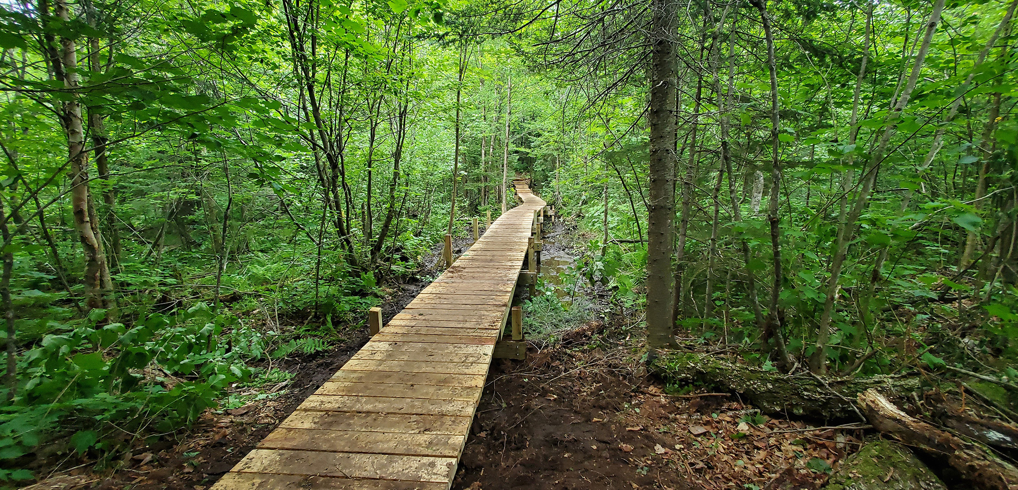
Moose Mountain Boardwalk Replacement Project:
It was a longtime in the making (finding and allocating the funds, and planning) but it finally happened! In July a group of us (Superior Trail Race organizers, volunteers and racers) got together with SHT staff and replaced the bad bad boardwalk through the upper Rollins Creek watershed in the Moose / Mystery valley. If you have run either the Spring or Fall races over the past few years, you know the one. This 160+ foot boardwalk is about 2.5 miles from the race finish, so all Superior Trail Race participants pass over it. It took nearly 450 volunteer planning and labor hours to get this one done – a huge thank you to all who donated their time! HERE https://photos.app.goo.gl/WG83rjotXahib4pc6 is a photo album from the project.
—

While we are getting the itch to get back to t-shirts for the event giveaway, we still have not done everything we want to do with hats. Last fall and winter we spent a ton of time designing, from the ground up, what we think is the perfect running hat. It hits on all the technical features you want in a running hat; breathable, lightweight, crushable and stowable, while still maintaining enough shape to look great. All runners and volunteers will receive this good looking hat. We ordered some extra so if you want to purchase an extra for crew, friends or family after the race.
—
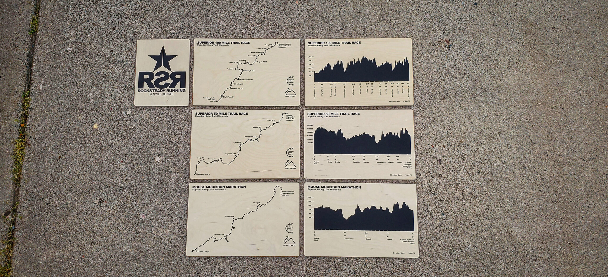
Another project we undertook over the winter is something we have wanted to do for a very long time. We are excited to introduce and offer for sale these super cool Superior Fall Trail Race course map(s) and elevation(s) chart art prints. We are producing these prints with a close friend of ours, in his local shop. Each print starts its life as a full sheet of plywood that we are going and picking up, transporting, ripping to size, routing, sanding, printing, packing and transporting to the race(s).
These are being printed with super durable UV inks, on high-quality pieces of 1/2″ baltic birch plywood. Please note that plywood has a lot of character – kind of a contemporary / industrial look. Each print will have its own unique variations of wood grain, and ‘imperfections’ (character). Please note that race courses are subject to change over time, with temporary or permanent reroutes. As a result the race route, elevation, distances and data represented on the print is not meant to be empirical / may change slightly over time. Over time we will update the artwork that we use to print these representing any significant course changes that end up becoming permanent.
17″W X 11″H Superior Fall Trail Race course map(s) (there is a specific coursemap for each race distance) $45, elevation chart(s) (there is a specific elevation chart for each race distance) $45, and 8.5″H X 11″H RSR logo art print(s) $30 each. Place your order by Thursday August 29 at 11:59PM and we will have your map / chart (s),ready for you to pick up on Superior Race weekend (Thursday check-in for 100 milers and Friday check-in for 50 & 26.2 milers). We will only have time / material to produce 100 orders – so this is on a first come first served basis. We accept cash, check, PayPal and Venmo on race weekend.
If interested, you can place your order HERE https://forms.gle/xkgzkK7Di1A8SfwT6
FYI, in the future we hope to get to the point where we will stock a few of these and have them available on our website for purchase as well, but expect them to cost about $10 more due to packaging and shipping.
—
VERY IMPORTANT – CAMPING OR SLEEPING IN YOUR VEHICLE IN THE LUTSEN PARKING LOT IS NOT ALLOWED:
Lutsen Mountain graciously allows racers to park in their large surface gravel parking lot, across Ski Hill Road from Caribou Highlands for both the Spring and Fall races. They have asked us, to pass a note to race participants that camping or sleeping in your car, van, truck, etc. is not permitted in their parking lot or anywhere on their property. Failure to comply with this could negatively impact the race. If you need somewhere to camp the night before or after the race we suggest one of the following fantastic options; Temperance River State Park, Lamb’s Resort, Grand Marais Recreation Area / Municipal Campground, Cascade River State Park, Black Beach Campground (Silver Bay), or Split Rock Lighthouse State Park. There are several other options in the area, here are some additional resources Visit Cook County and MNDNR / State Parks.
—
As always, a huge thank you to sponsors and partners. Please take a moment to click the link and check them out https://www.superiorfalltrailrace.com/sponsors/
If you are not quite ready to get back to what you were doing, linger a few more minutes and get stoked for what’s to come! https://www.superiorfalltrailrace.com/photos-2023-highlights/
That is all I have for you today, thank you for your time! Look for one final communication from me about a week out from the race. We can’t wait to see you all at Superior!
Thank You,
John Storkamp
Race Director
Superior Spring Trail Race